Multiscale real-time procedural animation of clouds and cloud systems

Advisors
Fabrice Neyret
Fabrice.Neyret@imag.fr
CNRS, LJK (Laboratoire Jean Kuntzmann)
Equipe-projet INRIA Artis
http://www-evasion.imag.fr/Membres/Fabrice.Neyret/
Eric Bruneton
Eric.Bruneton@inria.fr
INRIA, LJK (Laboratoire Jean Kuntzmann)
Equipe-projet INRIA Evasion
http://www-evasion.imag.fr/Membres/Eric.Bruneton/
Context
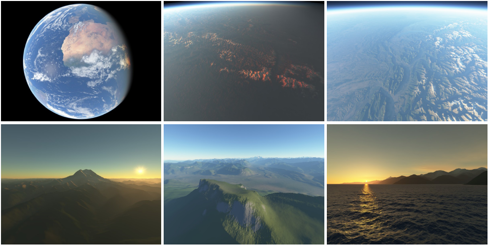
Many applications and games need to render in real-time realistic and very large natural scenes, potentially up to whole planets. This includes Earth browsers (Google Earth, Bing Maps 3D, Nasa WorldWind, Geoportail, Celestia), flight simulators, realistic games on very large terrains (Crysis, Fuel), etc. However, existing solutions providing highly realistic renderings are restricted to small domains and limited user movements, while those providing full navigation capabilities are less realistic and suffer from popping or other artifacts. There is not currently a virtual Earth model with real-time highly realistic rendering and animation, where users are free to move and look anywhere. The goal of the ANR project SimOne, for Scalable Interactive Models Of Nature on Earth, is to make a first step towards this long term goal. This project does not start from scratch, but from an existing virtual Earth browser prototype called Proland, developped at INRIA, and which can already render the terrain, the atmosphere and the deep ocean at all scales (see above teaser and links).Description
In this context, the subject of this thesis is to propose, implement and evaluate real-time procedural animation models for clouds at all scales, from individual clouds to large cloud systems at the planetary scale. The goal is not to perform exact simulations, but only to get plausible shapes, distributions and animations. Moreover, we want to have high-level handles that a user could control on desire. Earth is large and the viewer can visit any location, so we need scalable approaches, which do not compute and store everything, and which adapt to visibility and distance.At small scale (kilometers) the goal is to reproduce, in particular, the rising of thermals and the formation of cloud puffs, accounting for thermodynamics, phase changes, and local fluid circulation ("small scale" means clouds seen from short distances, not a small domain: animating clouds at this scale should be possible anywhere on Earth). At medium scale (dozens of kilometers) the goal is to reproduce the effects of topography, winds and self-organizing patterns on the distribution and type of clouds. (Typical patterns are Benard cells, trails, etc). Finally, at large scale (Earth), the goal is to reproduce the motion of air masses and fronts, resulting from large scale patterns like Anticlones/Cyclones, Hadley cells, etc.
Theses 3 scales are largely decoupled, and allow to visit various aspects of Computer Graphics (simplified physical simulation, pattern generation, vectorial animation). They can be studied independently, then the connections and transitions investigated. For this, new representations and algorithms have to be invented, from existing tools in Computer Graphics, or directly inspired from the high level knowledge of physics and meteorology literature.
More details and bibliographic references about this subject can be found here.